

Dron-based y
Security and defense
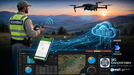
Our solutions integrate drones, Geographic Information Systems (GIS), and advanced analytics to strengthen surveillance, inspection, and monitoring operations. We centralize geospatial information, aerial imagery, and operational data on a platform that facilitates real-time strategic decision-making.
From flight planning to the generation of photomosaics, digital elevation models, and spatial analysis, we provide tools that optimize operational coverage and enhance safety in critical environments.
Technology driving
intelligent operations
Flight planning
Route design and optimization to maximize coverage and reduce operating times.
Photogrammetry
Generation of orthomosaics, 3D models, and point clouds for high-precision analysis.
Real time monitoring
Visualization of operations, asset tracking, and live information transmission.
Geospatial Intelligence
Integration with ArcGIS for advanced spatial analysis and decision-making support.
We transform data into strategic decisions.
Ready to strengthen your operations?
Discover how our drone and geospatial intelligence solutions can optimize your organization's surveillance, monitoring, and decision-making.
Request a demo
Risk Monitoring and
Mitigation
with GEOIA
GEOIA integrates artificial intelligence, drones, and Geographic Information Systems to detect risks, automate data analysis, and strengthen decision-making through continuous monitoring and georeferenced evidence.
The platform enables the early identification of incidents, the assessment of their impact, and the generation of strategic information that optimizes operational response and improves comprehensive risk management.
